Created by Émile Bourdelin, an industrial designer and engineer, the map of Paris as the crow flies offers a vision of the capital at the very moment when it was reorganised, on 16 June 1859, going from twelve to twenty arrondissements by the absorption of eleven neighbouring communes, from Belleville...
Read more
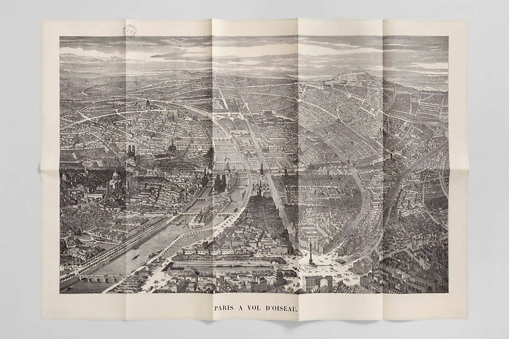
Created by Émile Bourdelin, an industrial designer and engineer, the map of Paris as the crow flies offers a vision of the capital at the very moment when it was reorganised, on 16 June 1859, going from twelve to twenty arrondissements by the absorption of eleven neighbouring communes, from Belleville to Vaugirard, from Auteuil to Montmartre.
Map
Folded size: 19.6 × 33.8 cm
Unfolded size: 98 × 67.6 cm
A card on the front, its story on the back
Bilingual French-English
Reliefs Éditions
Co-published with the BNF (The national Library of France)
Close